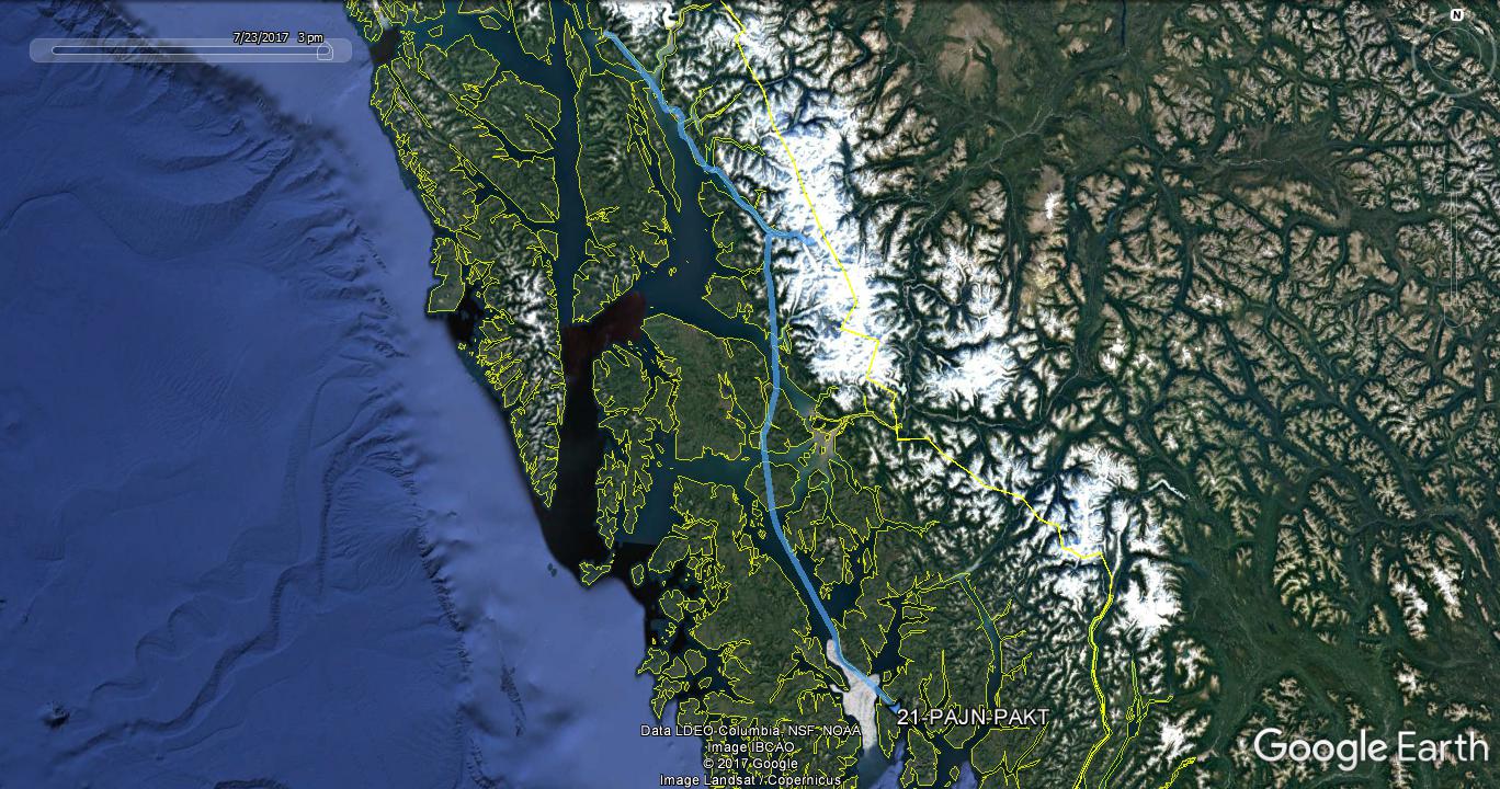
While Juneau isn't nearly as remote as Barrow, they're similar in that neither are connected to the continental road system. The Alaska Marine Highway ferry system does provide vehicle access to Skagway and Bellingham, but I think it's much better getting there by air!
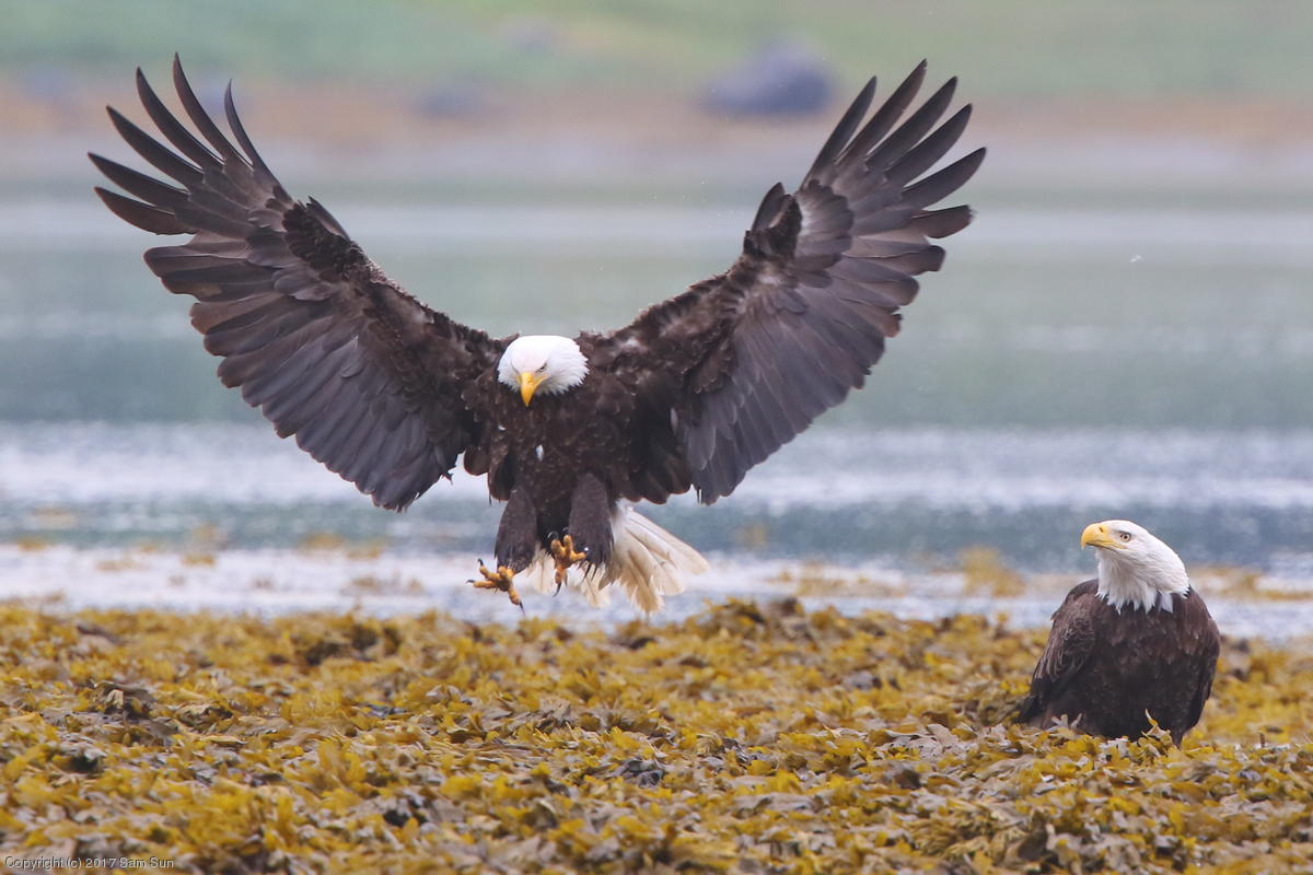
I spent the day visiting the state capitol, and the surrounding Douglas Island and Mendenhall Glacier. The salmon run was in full swing at the aptly named Salmon Creek, where a large number of eagles and gulls had gathered to feast.
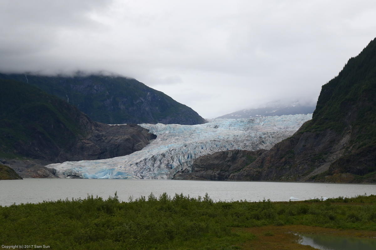
The Mendenhall Glacier is billed as one of the must-see stops in Juneau. All well and good, except it meant that it was also easily the most crowded area I'd visited on the entire trip. Cruise ship excursion busses rolled through regularly, bringing waves of visitors. The glacier itself has retreated significantly in the years since the visitor center was built, and by some forecasts will not be visible from the visitor center at all by the end of the century.
| Mendenhall Glacier | Bald Eagles |
|
|
|
After another visit to Salmon Creek to watch the eagles fishing, it was time to leave Juneau. While loading up at the airport, I learned the tiedown row at Aero Services isn't the greatest place to park, especially at the northern end where I was. There is a helicopter operator immediately adjacent, and they hover taxi down the narrow lane between the parking areas. I got blasted twice in the short time I was loading up - enough so that the wings were rocking.
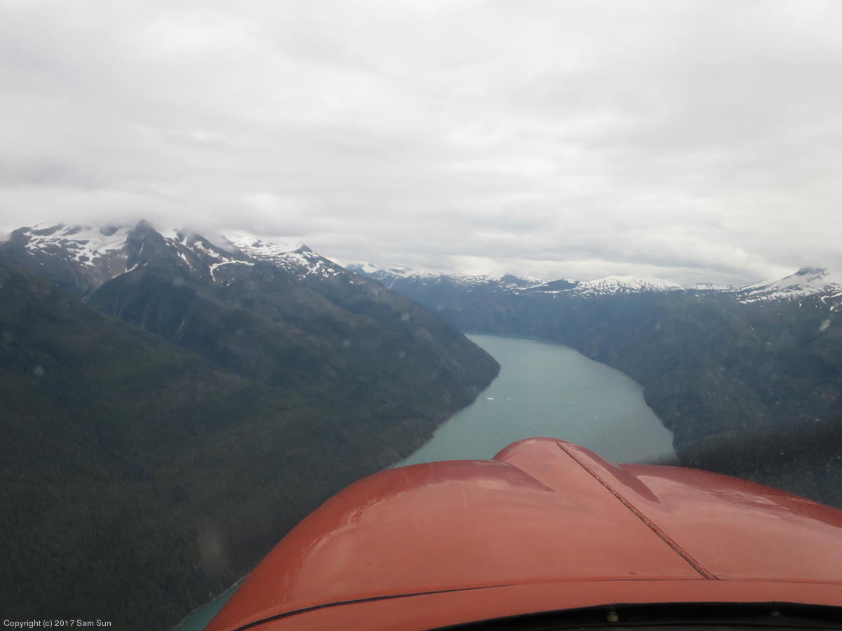
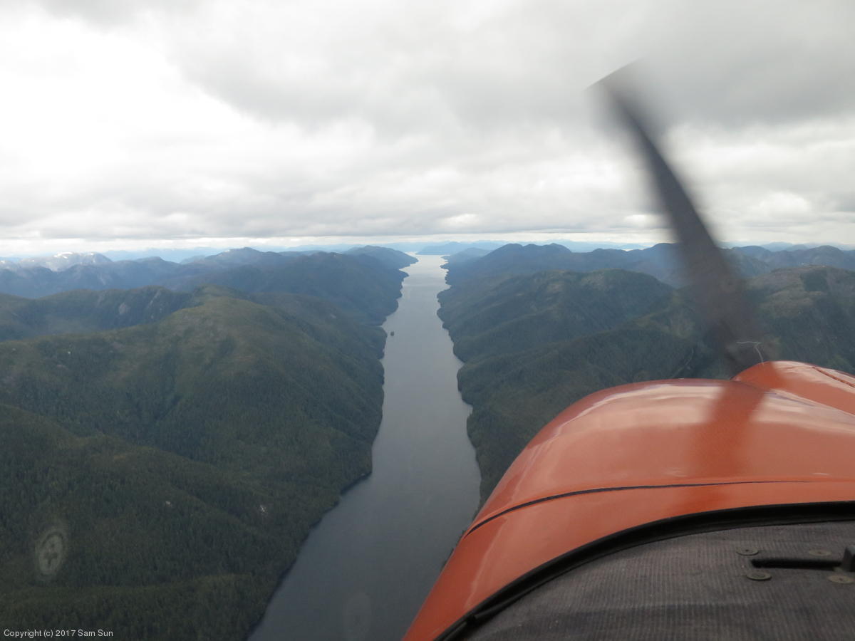
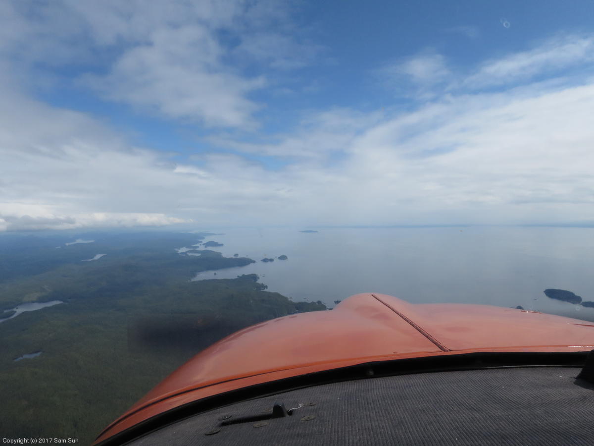
The clouds were high enough to allow a bit of exploring on the way to Ketchikan. I elected to fly up the Endicott Arm and over the Dawes Glacier. Breathtaking scenery again, though most of the mountain peaks were hidden behind clouds.
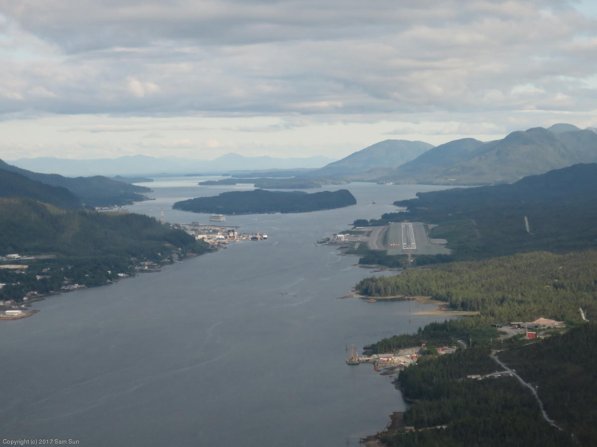
Ketchikan is charted as a Part 93 Special Flight Rules Area, essentially mandating the use of the CTAF. While there was quite a bit of air traffic in the vicinity, including opposite direction floatplanes coming up the channel, the approach didn't seem quite as intimidating as all my reading of it led me to believe.
| The Endicott Arm | Final approach at Ketchikan |
|
|
Transient parking is down taxiway C on the lower ramp. Because you have to cross a secure area to get to the terminal, the drill is to call the FBO (Aero Services) for a ride. They fuel out of trucks, so I took care of that at the same time.
The Ketchikan FSS is on the upper floor of the terminal building. As had become my habit, I paid them a visit to see about details for the next day's flight down the coast. I was planning a dogleg to Prince Rupert to avoid crossing the corner of the Canadian ADIZ that was in the way, and the briefer concurred. He advised that no squawk code was necessary crossing into Canada, but that I should make sure to pick one up with Canadian flight service enroute before entering Washington.
Ketchikan to Bellingham is 520nm direct. However, after routing around the Canadian ADIZ and higher terrain, the trip is closer to 560nm. Though it involves flying through Canadian airspace, there's no need for customs unless a landing in Canada is made. The nonstop would take around 4.3 hours out of a fuel endurance of 5 hours at my typical full throttle cruise at altitude. Not much margin for error. With forecast ceilings around 4000' enroute, I opted to fly a low cruise power that would lengthen the trip to 5 hours, but with over 6 hours of endurance.
All this because I was unenthused at the idea of having to clear customs twice just to refuel in Canada. CANPASS wasn't an issue; but I'd have to make 2 eAPIS filings, and arrange a 15 minute arrival window at Bellingham while accounting for a fuel stop and potential ATC delays in the congested airspace around Vancouver. Prior to 9/11, it was apparently possible to make a "technical stop" for fuel in Port Hardy, staying on the airside and not clearing customs, and then re-entering the US without customs as if the stop never happened. No more though.
The flight was uneventful. I set cruise power shortly after taking off from Ketchikan, and never had a concern on range - the JPI showed plenty of reserves from early on.
Over the water, the overcast slowly gave way to clearer skies as I headed south, while over land, the convective cumulus was building up. In addition to Price Rupert and Bella Bella, there were some smaller communities and a fair amount of boat traffic along the way. It didn't feel particularly desolate after some of the other legs I'd flown on this trip. Still, there weren't many good landing options - in most places the forest came right down to the edge of the water, with few sandbars or beaches. I figured my best option in the event I lost power was to ditch in the water as close to the shoreline as I could.
Passing Texada Island, I contacted Vancouver Terminal approaching their Class C airspace. They routed me across the strait towards Nanaimo, then along the barrier islands to East Point and across to Bellingham.
| Ham Island | Grenville Channel |
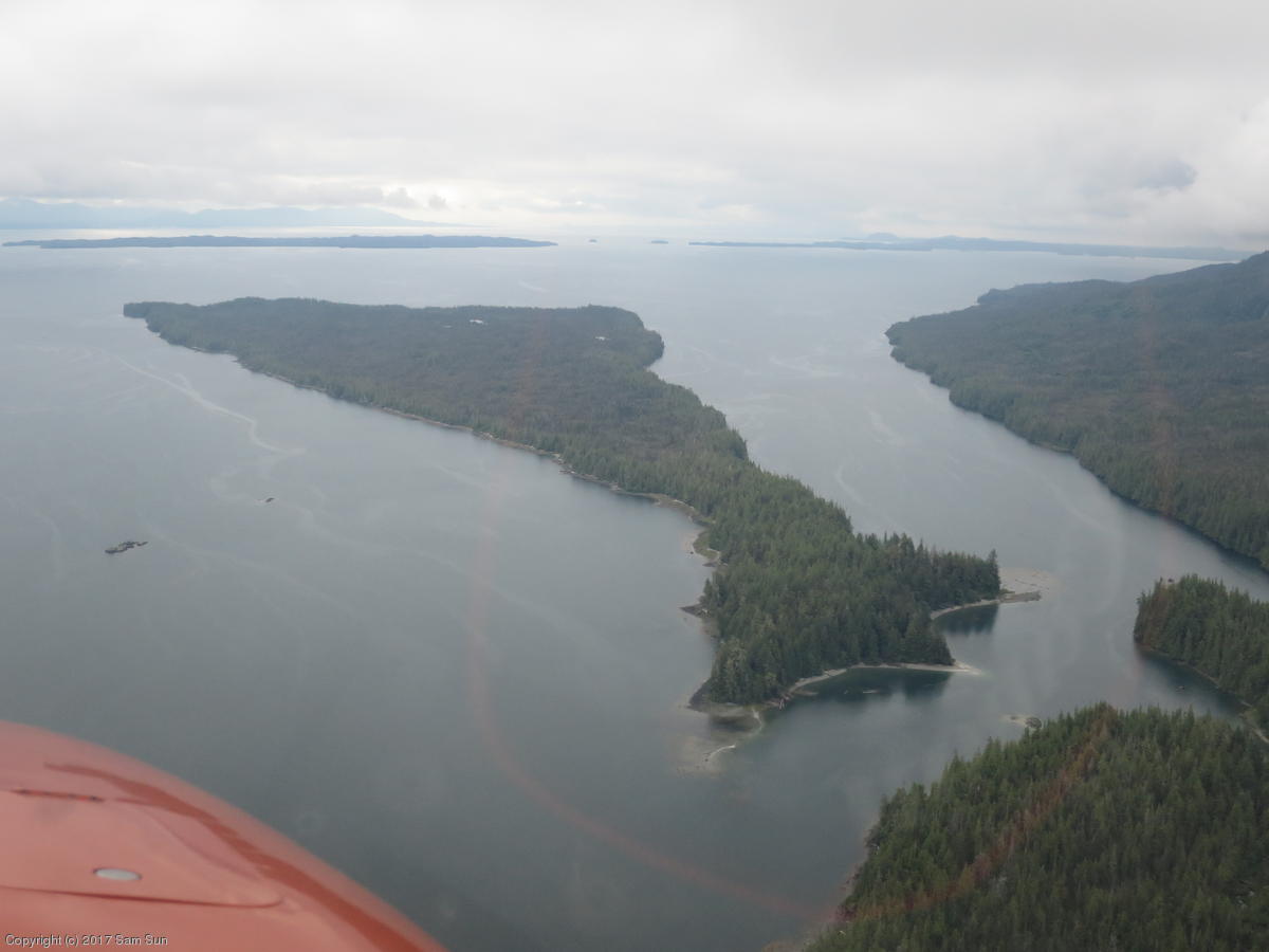
|
|
| Across the strait from Port Hardy | Back in the lower 48! |
|
|