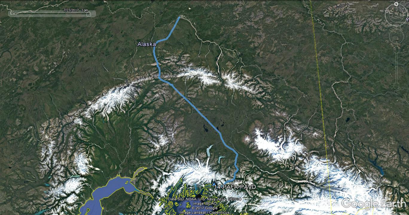
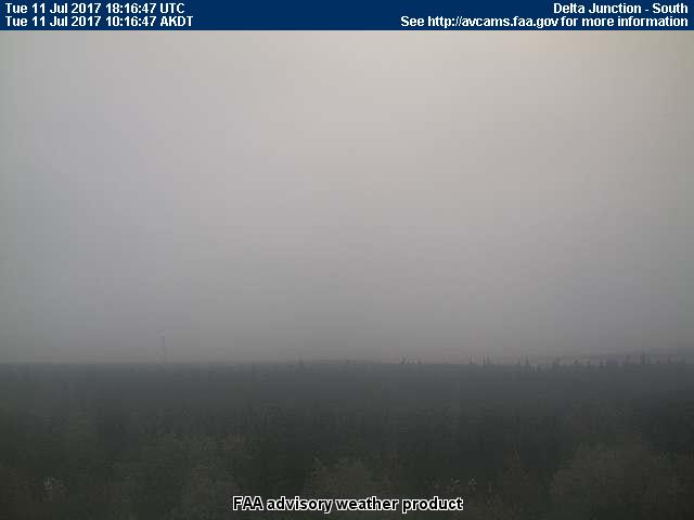
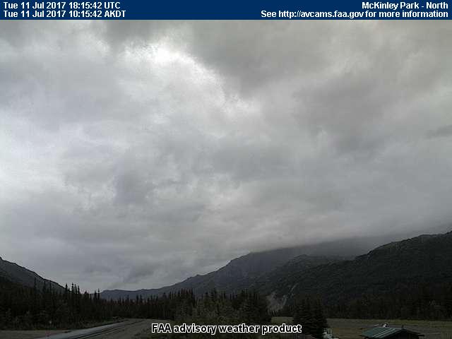
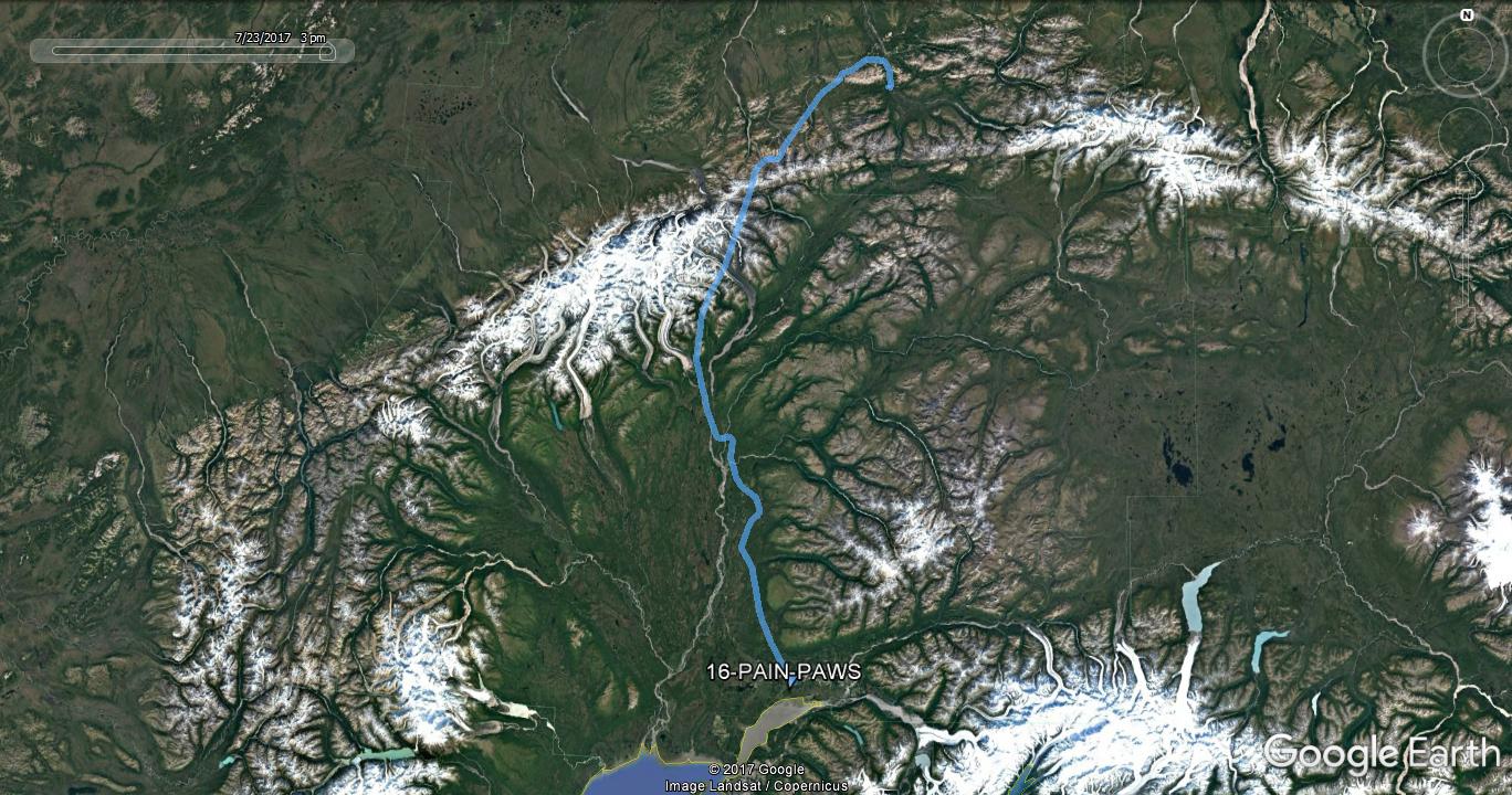
The days plan was to get down to Valdez for a couple days of forecast sunshine there. While the skies in Fairbanks had cleared out, Delta Junction was flirting with IFR due to rain and low ceilings, so I elected to fly a more westerly route via Healy/Windy Pass, then cut across towards Gulkana. If there was any doubt, the FAA aviation webcam site made it clear that south of Delta Junction was looking bleak.
| Delta Junction WxCam | McKinley Park WxCam |
|
|
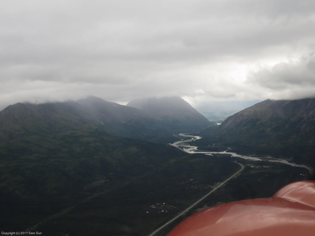
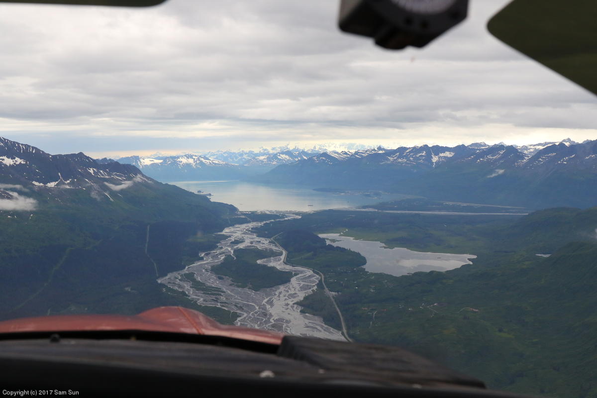
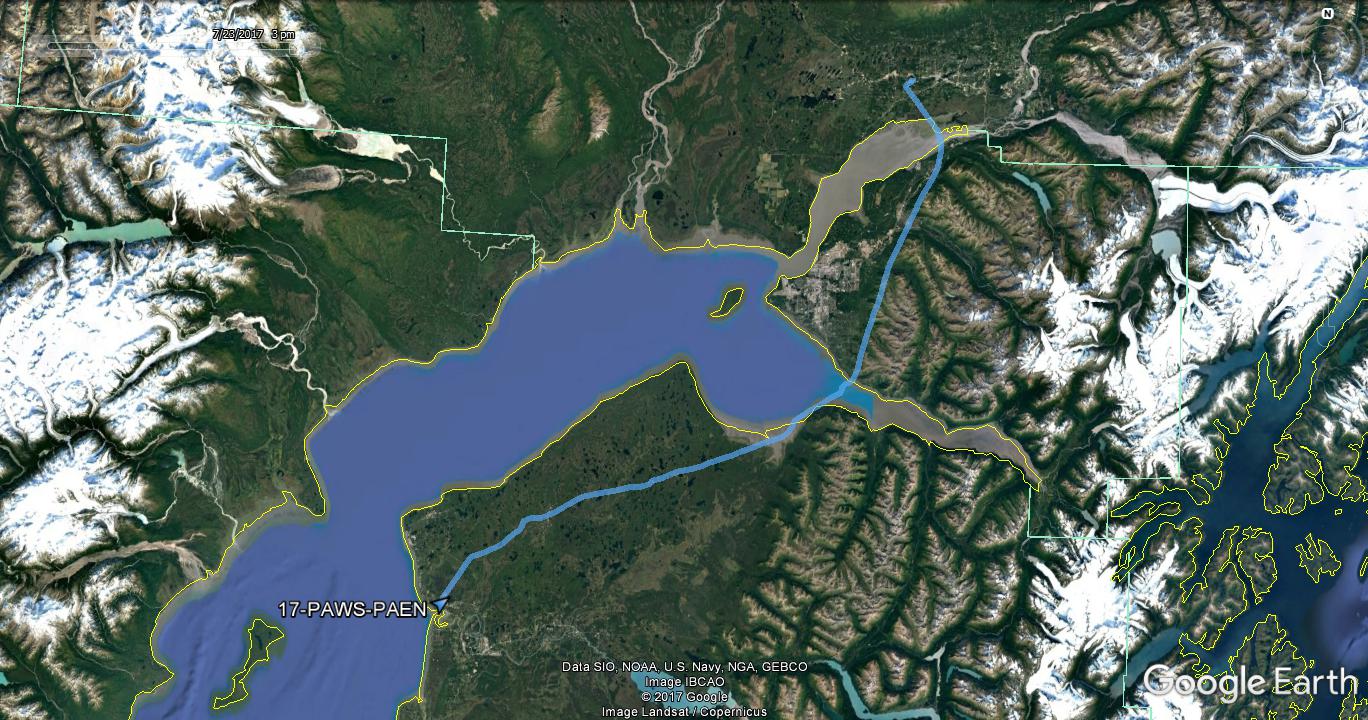
Clouds once again obscured some of the higher mountains going through Thompson Pass approaching Valdez. Despite the clouds, turning the corner to see Port Valdez was another of those "wow" scenery moments on the trip.
| Windy Pass | Port Valdez |
|
|
I had called the folks at VS Helicopters at Valdez to check on fuel availability. There was no FBO entry in AirNav, and the Chart Supplement has the uninviting note "fuel by PPR only", but all it really meant is that someone had to come out and unlock the fuel terminal cabinet. They're happy to sell fuel and indicated they would look into updating the AirNav entry.
It happened that the Bonanza pilots I had parted company with had made their way to Valdez a few days before, so I met up with them again to share stories of our Alaskan experiences. They left the next morning to start their trip home.
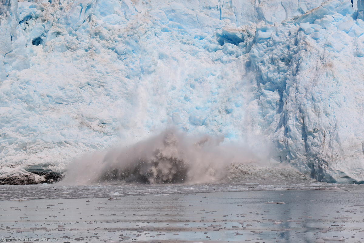
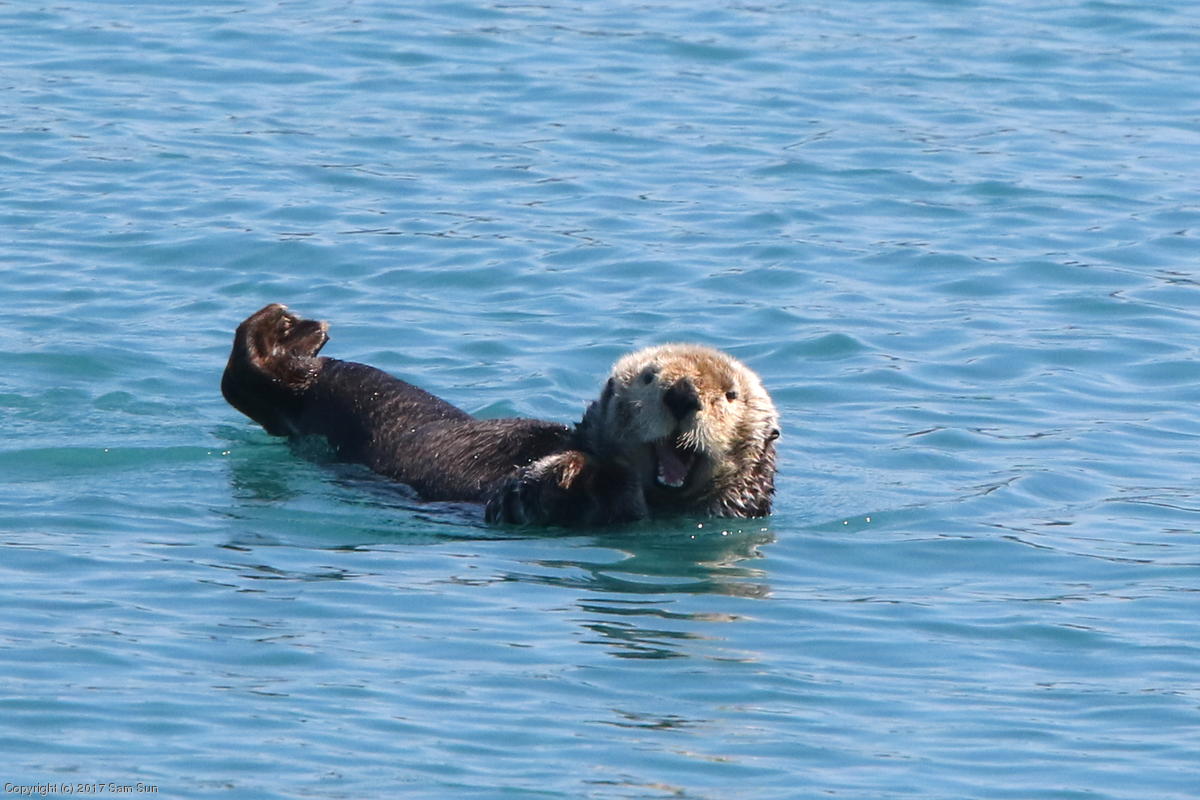
I got the hoped-for blue sky day for the Stan Stephens Meares Glacier cruise. There was plenty of room as the ship was only half-full. Unlike what I later read about some of the Juneau cruises, passengers had the run of the ship - even the wheelhouse. While we did see a variety of wildlife, the online reviews I had read were accurate in that the focus of the cruise was the glacier (the Kenai cruises being better for wildlife). We wound up spending close to an hour at the glacier, and saw two good-sized calving events.
| Calving glacier | Sea otter |
|
|
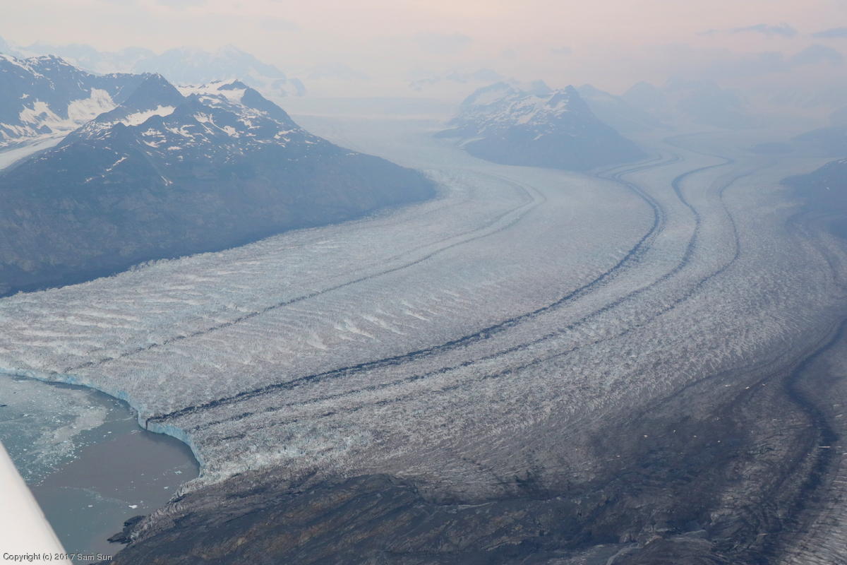
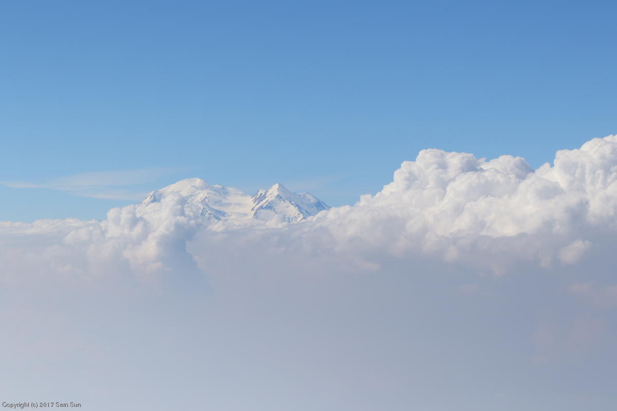
With rain approaching Valdez, I attempted to seek better weather back north at Denali. Unfortunately, while many stations were reporting "clear", haze and smoke really cut down visibility. The smoke had blown in from wildfires far to the east in the Yukon and blanketed the entire valley. Though it was hazy along the coast, the glacier views leaving Valdez were still breathtaking! I was surprised by how large the Columbia Glacier was (and it's 8 miles shorter than charted). There was also a lot more to Meares Glacier than what I saw from the water the day before. Perhaps due to downslope winds generated by the glacier, I found I wasn't climbing as quickly as usual flying up the glacier, and executed a 180 to continue the climb unobstructed.
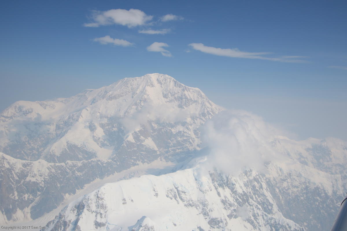
Approaching Denali, I climbed all the way up to 17000' to try to clear the haze and smoke and get a good view of the mountain. I could hear tour operators on the Denali CTAF operating below, but had a hard time identifying reporting points through haze. Perhaps they would have been more obvious on a clear day down lower, but it suited me to fly in what I presumed to be less congested airspace up high (nobody else was on the high altitude CTAF).
| Columbia Glacier | Denali |
|
|
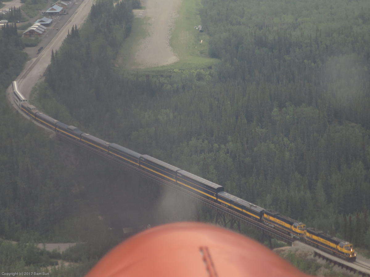
On the north side of the range, I located the park road in the smoke and followed it to the airport. I've landed on a couple grass strips and a lakebed runway in the past, but McKinley National Park Airport was my first experience with a gravel strip. On my first approach, I was a little high and fast, and the Alaska Railroad train was just crossing the trestle on short final to the airstrip, so I elected to go around. The second approach was much better. My impression was the gravel was not as draggy as grass, but maybe a bit bumpier. I didn't specifically think to do it, but luckily I drove into position in the parking area. I discovered after shutting down that I was not going to be moving the airplane on the gravel unassisted.
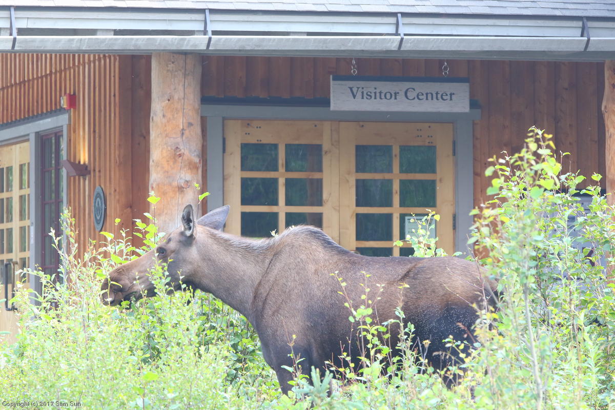
The visitor center was just a few minutes walk from the airport. The park offers free shuttles 15 miles into the park to Savage River, or paid shuttles that run the entire 90 miles of road to Kantishna. I elected to ride the shorter, free shuttle, hiked the Savage River Loop Trail, and returned to the visitor center to find a moose with her two calves.
|
The Alaska Railroad on short final to McKinley National Park Airport |
A visiting moose |
|
|
I hadn't made any lodging arrangements, but I found to my pleasure that while the Grande Denali Lodge listed rooms online at close to $400, calling them resulted in finding a "same-day special" that brought it down to $229. The dinner at Alpenglow Restaurant was really good, but pricey!
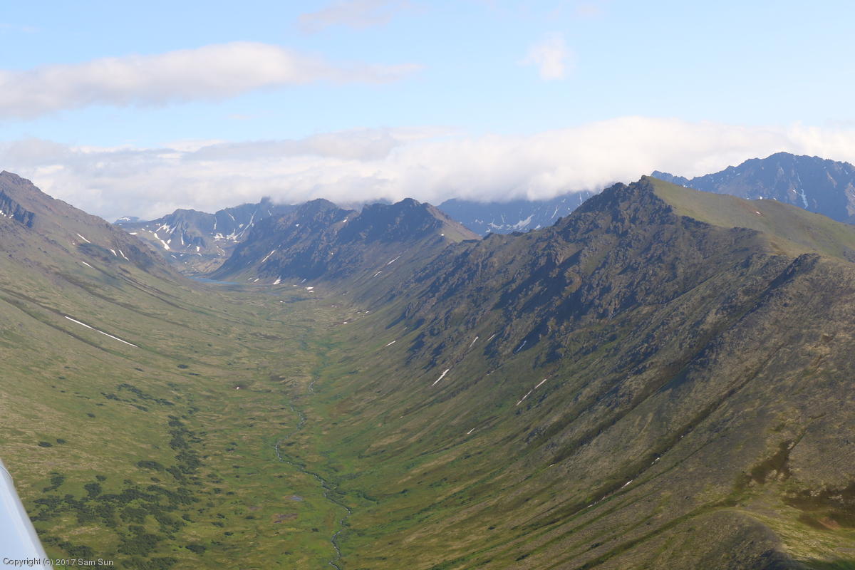
After another short hike in Denali, I departed McKinley Park using what I hoped were adequate gravel procedures. Just enough power to get rolling out of the parking spot, skipped the static run-up, kept the plane rolling through a 180 at the end of the back taxi, and off I went. I did check the mags once airborne, and climbed out above some clouds in the area to have another look at Denali. It was a clearer day, but the bases of the mountains were all shrouded in clouds.
I had been thinking it was about time I should do an oil change. When I started asking around, it turned out most shops were using Phillips instead of the Aeroshell that I was. I've heard it's best not to mix oils due to different additives, so I kept searching. One shop didn't carry the CH-110 filter, and despite all the other items I had brought along, an extra oil filter was not among them. Oops. I stopped in Wasilla to refuel and found the shop there stocked Aeroshell, so I got my oil change.
| Cumulogranite |
Campbell Creek Canyon near Anchorage |
|
|
Kenai was reporting 6000' overcast, so when I encountered a layer of clouds south of the Cook Inlet, I stayed below to watch the world go by. But then the bases started lowering, and before long, I was pushed down below 1000'. Darn that localized, unreported weather! The clouds stopped a few miles shy of the airfield.