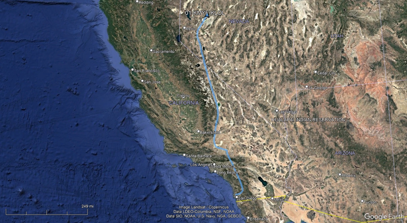
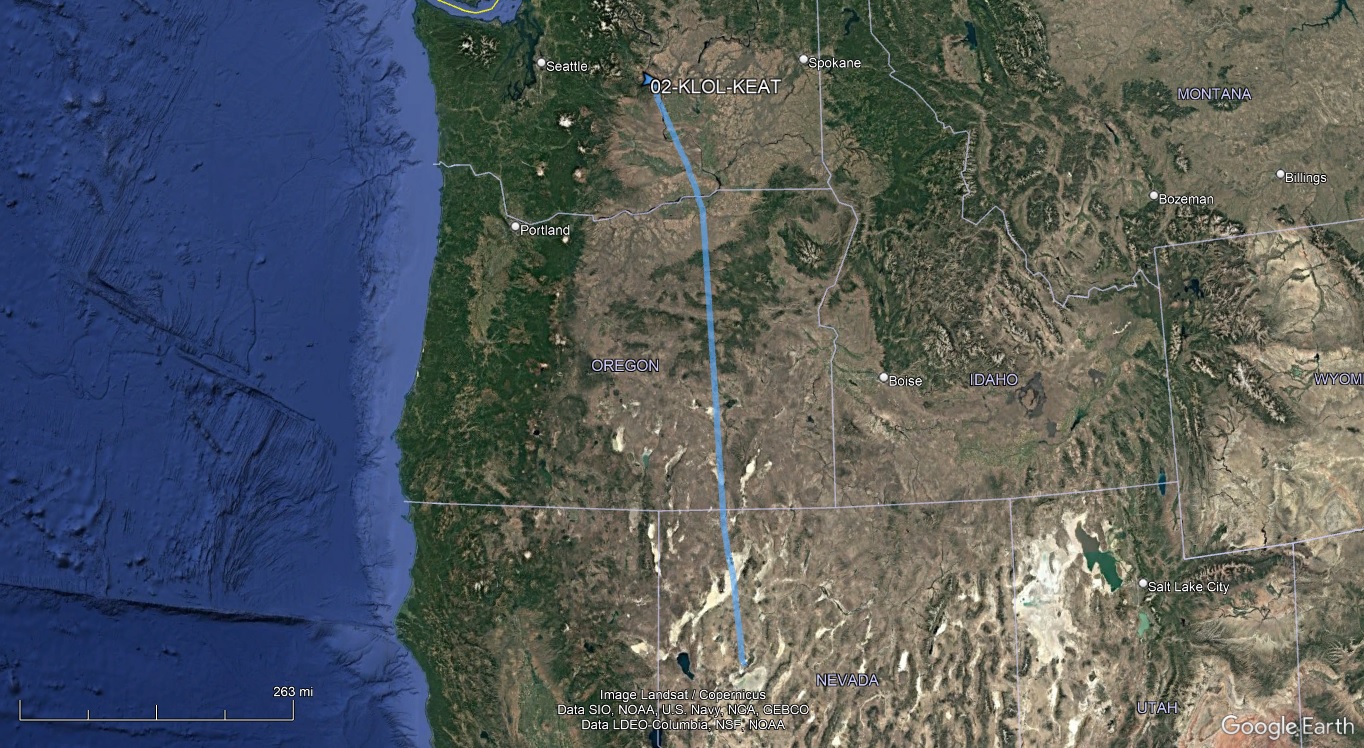
The goal for Day 1 was simply to get within range of the Canadian border for a short border crossing flight the next day.
There was a 2500' overcast at Montgomery in the morning, extending inland a little beyond Gillespie. Recently, I've often encountered lengthy delays getting IFR clearances out of MYF, so I departed VFR to the east. The ceiling was low enough I called Gillespie Tower for a transition of their Class D, but was soon able to turn northbound and continue my climb.
Coming through the Cajon Pass, I was disappointed to learn from Joshua Approach that transits of the Edwards Air Force Base restricted area R-2515 will no longer be possible for the forseeable future. It was often the case that overflights would be approved for a more direct flight to places along the Eastern Sierras. I had to go around via Lancaster and Mojave. Then it was up the Owens Valley towards Lovelock to refuel, and pretty much direct to Wenatchee after that.
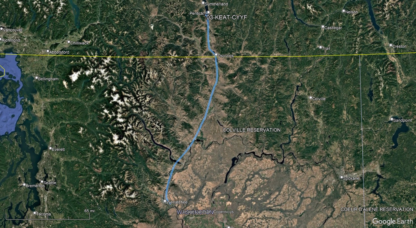
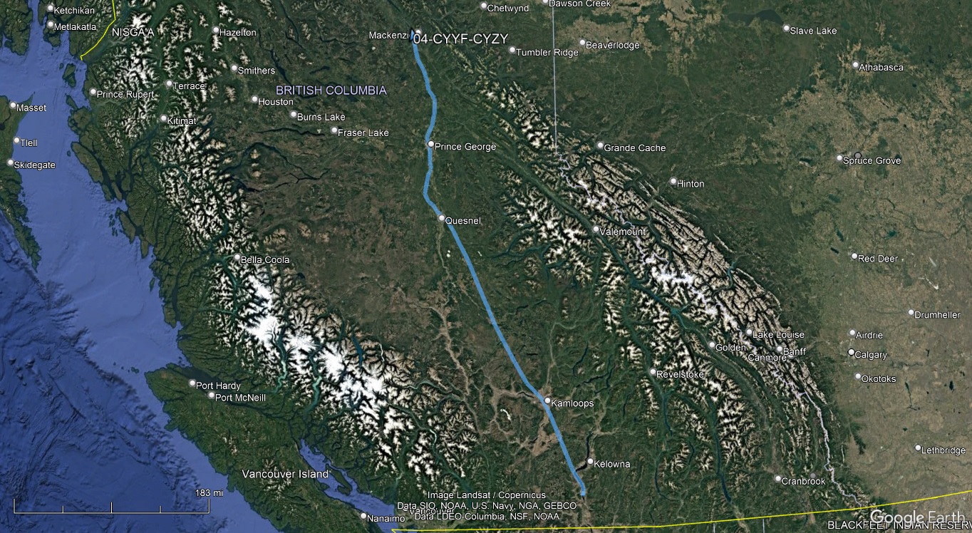
Having been through Kelowna twice, I chose to clear Canadian customs at Penticton this time. I duly filed my eAPIS departure notice and called CANPASS to advise of my flight the evening before. I've noticed the calls are much abbreviated now, presumably because they have my information from past flights - I wasn't even asked for my passport number. Prior to departure, I filed the required international VFR flight plan, then activated it once airborne and obtained the squawk code for the border crossing from Flight Service.
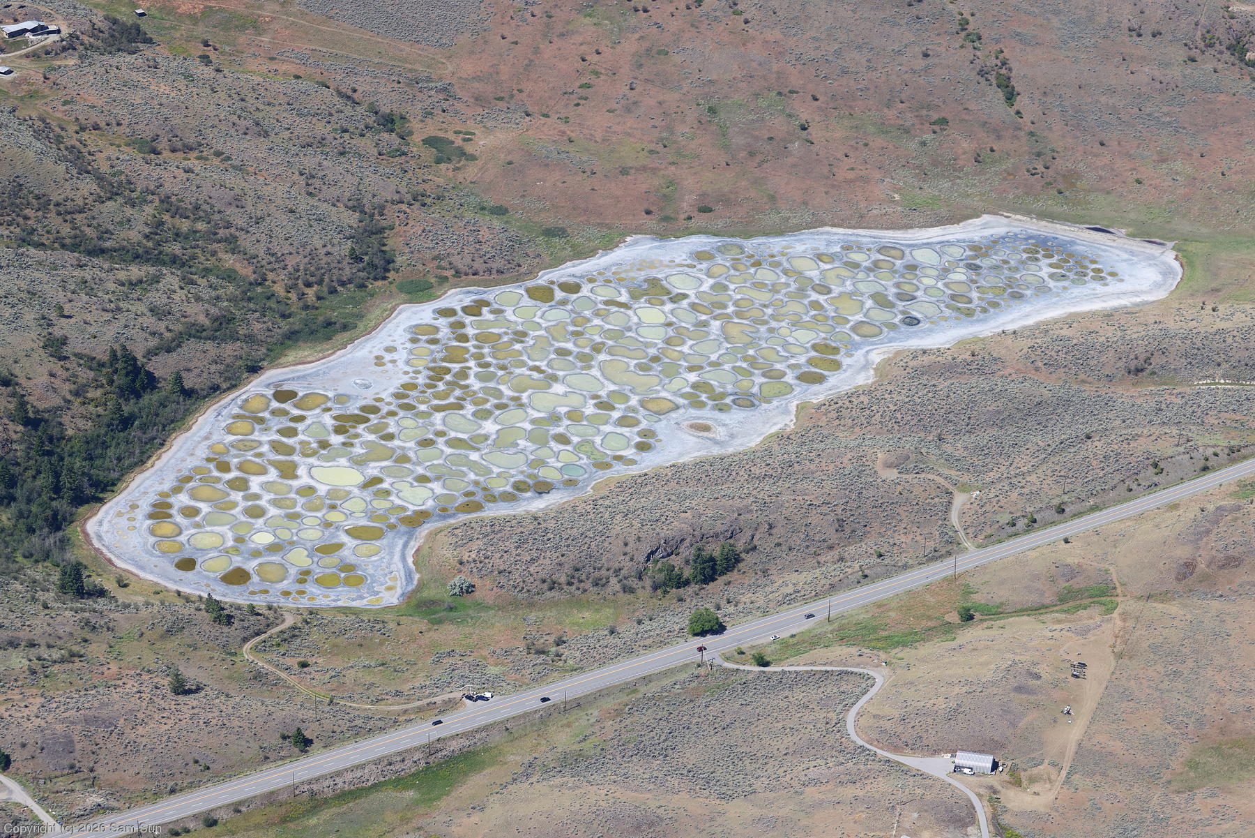
I followed the Columbia and Okanogan Rivers north, and after crossing into Canada made a point of checking out Spotted Lake. As the highly mineralized water evaporates from the lake during the summer, it leaves behind numerous small pools of varying colors resulting from slightly different mineral compositions.
After landing at Penticton, I was directed to a corner of the ramp to call customs. Anticipating being cleared quickly over the phone, I made the CANPASS call without even shutting down, to avoid a restart for the short taxi to fuel.
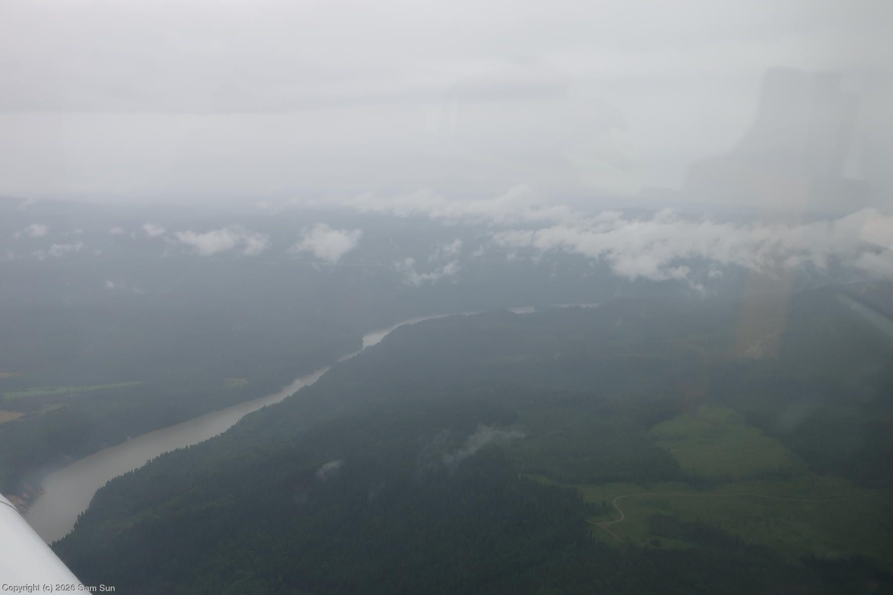
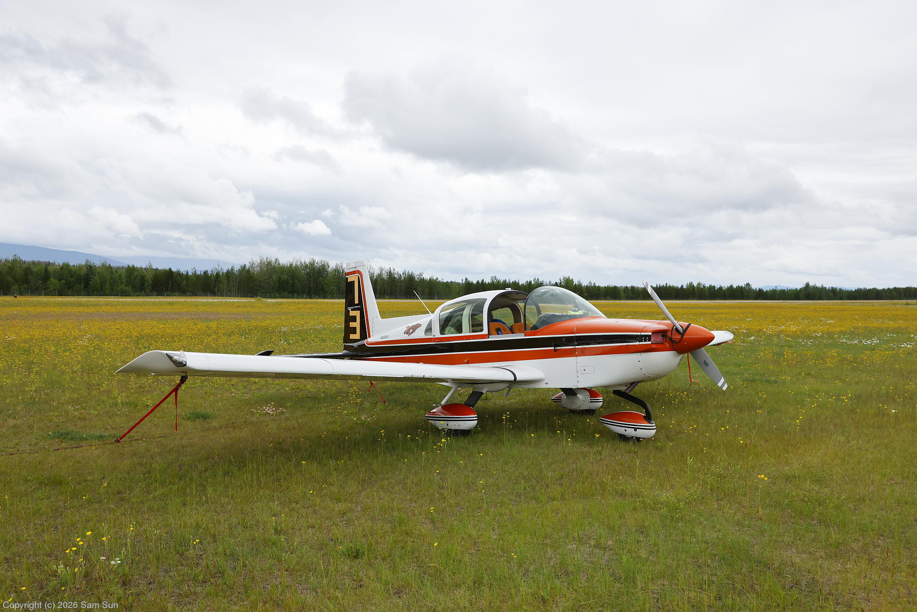
The weather forecast for the next leg to Mackenzie looked reasonable: mostly 6000' ceilings with some temporary 2000'-3000' broken layers in light rain as I moved north. The reality I found was closer to a 1000' ceiling in places. As the clouds slowly pushed me lower, I followed the Quesnel and Fraser Rivers north through the gloom. Passing Prince George, the ceiling improved, but while the airport was reporting a 6000' ceiling, it sure didn't feel like it. The rest of the flight to Mackenzie was uneventful. The tiedown area at Mackenzie is a grassy field, and I did a bit of lawn mowing getting parked.
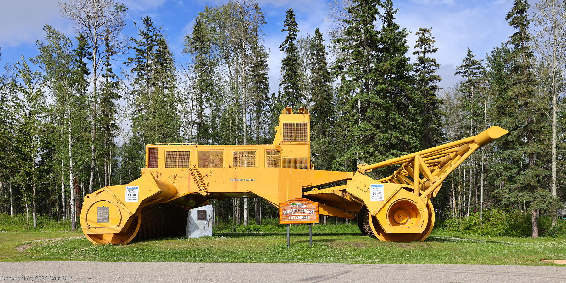
Mackenzie is an out-of-the way small town. The World's Largest Tree Crusher serves as a Route 66-like roadside attraction. Most visitors drive into the area renting a car out of Prince George as there's no rental car or taxi service available in town, nor does the hotel offer an airport shuttle. I arranged a ride into town ahead of time with one of the FBO staff, a nice gentleman by the name of Neil.
Why choose Mackenzie for a stop then? Mostly logistics - stopping at Prince George would have made for a very short day, and would have added an hour and a second fuel stop to what would already be a long day the next day to get to Dawson City. Besides, I'd overnighted at Prince George on my previous Alaska trip, and I wanted to hit some different places this time.
| Spotted Lake |
 |
| Gloomy along the Quesnel River |
 |
| Tied down at Mackenzie |
 |
| World's Largest Tree Crusher |
 |
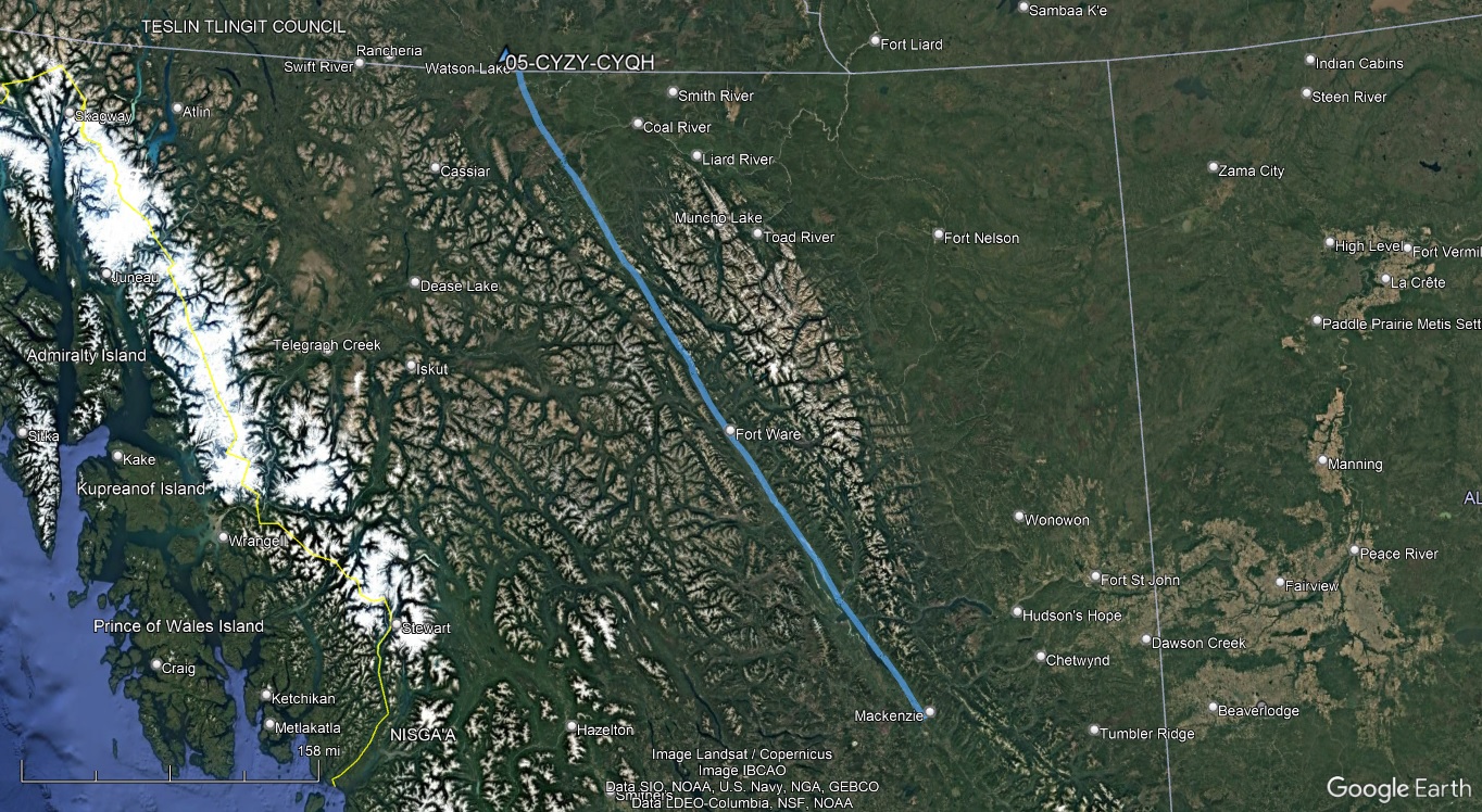
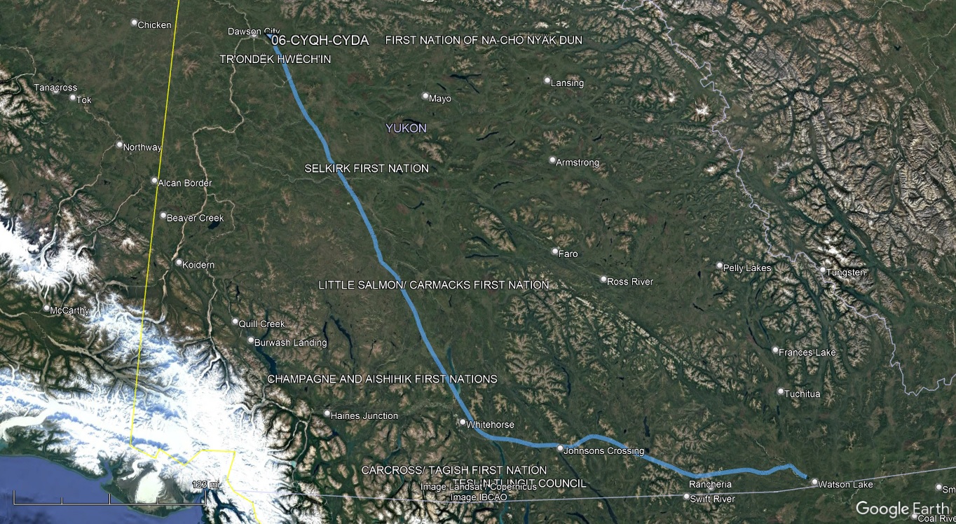
In the morning, I was faced with broken 900' ceilings at the airport. Whereas the METARs the day before seemed better than the actual conditions, today things didn't look as bad as the METAR suggested. The layer wasn't very thick, and it also appeared to be clear to the northwest in the direction I was heading. It was uncontrolled airspace, so I could depart VFR, but I was reluctant to do so given what's typically considered an IFR ceiling. I stalled a while, recalling my previous trip up the Trench Route, where low ceilings at the pass at the north end of Williston Lake almost kept me from getting through. Weather reports from the north this time were fine though, and as the ceiling lifted to 1100', I decided to launch and see how things looked. What I found was that the airport was pretty much at the edge of the overcast layer, and the clouds quickly scattered out to the north.
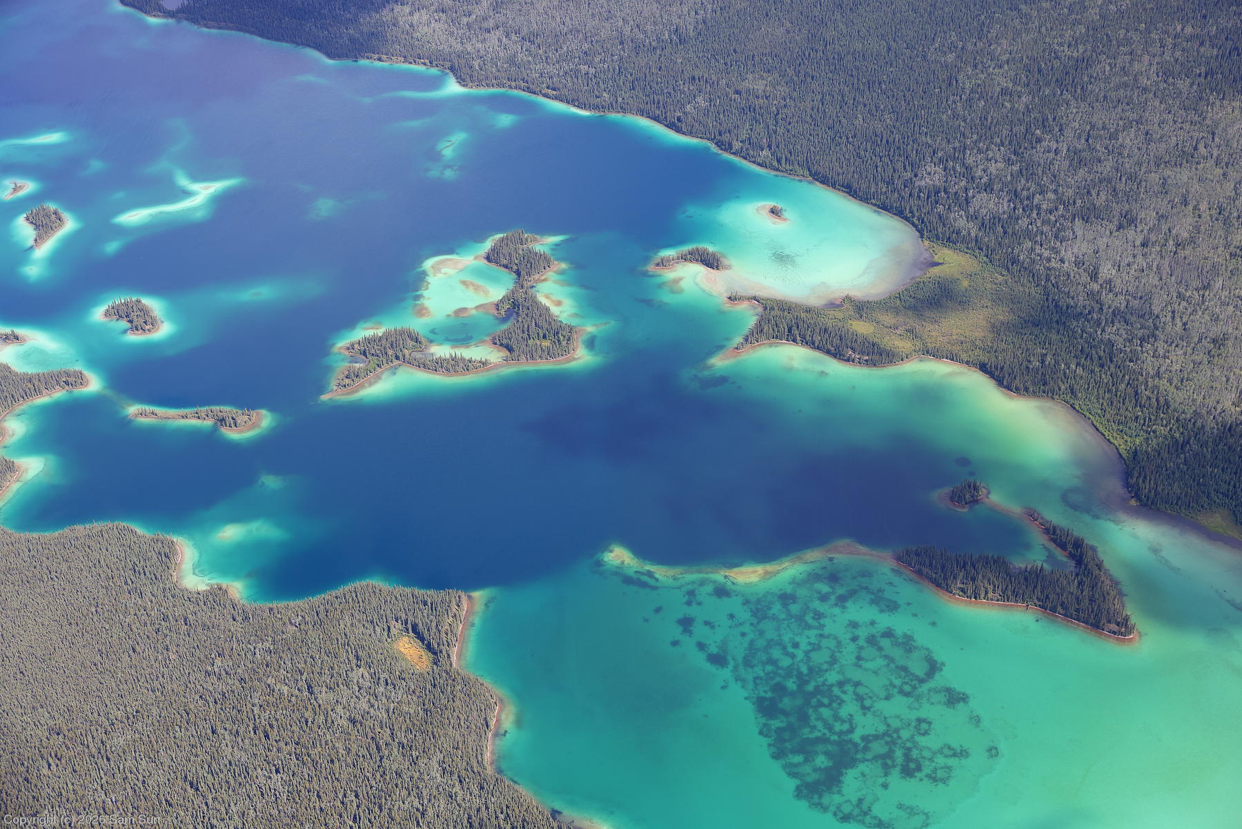
It was a scenic flight up Williston Lake. The mountains along the lake topped out at a moderate 7500' or so, but were still streaked with snow. Heading into the Kechika River valley, many of the small lakes, including one named Aeroplane Lake, are a stunning cerulean blue.
There were several planes refueling at Watson Lake, and I couldn't help but note they all carried US registration. We were all either going to or coming back from Alaska.
Ceilings developing to the north precluded a more direct path to Dawson City via Faro, so I doglegged to the west via Whitehorse and Carmacks instead. As with the day before, while the forecast ceilings at the few terminals in the area were all at least 5000', the actual ceilings at points in between were quite a bit lower. Visibility was good despite the occasional rain showers, and I meandered north around some of the murkier areas without much difficulty.
| Aeroplane Lake |
 |
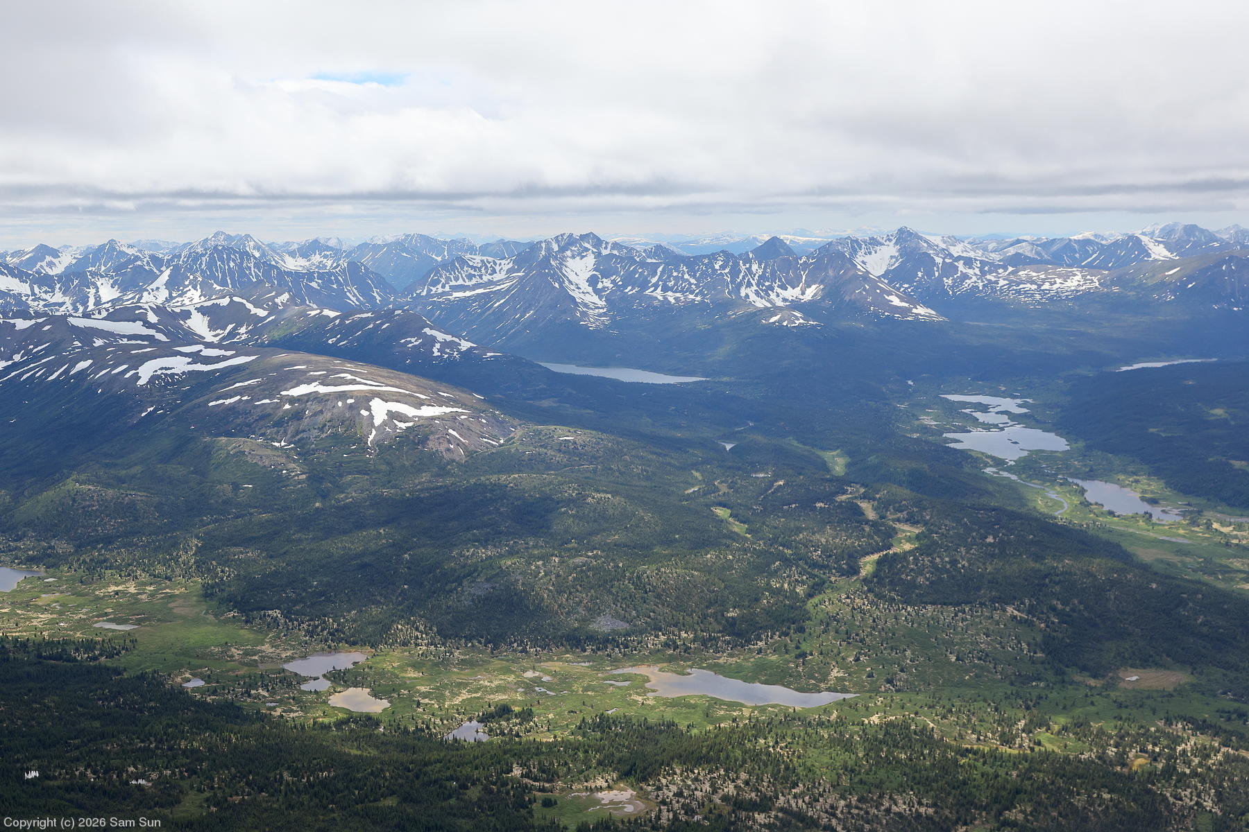
| Dorsey Range, east of Whitehorse |
 |
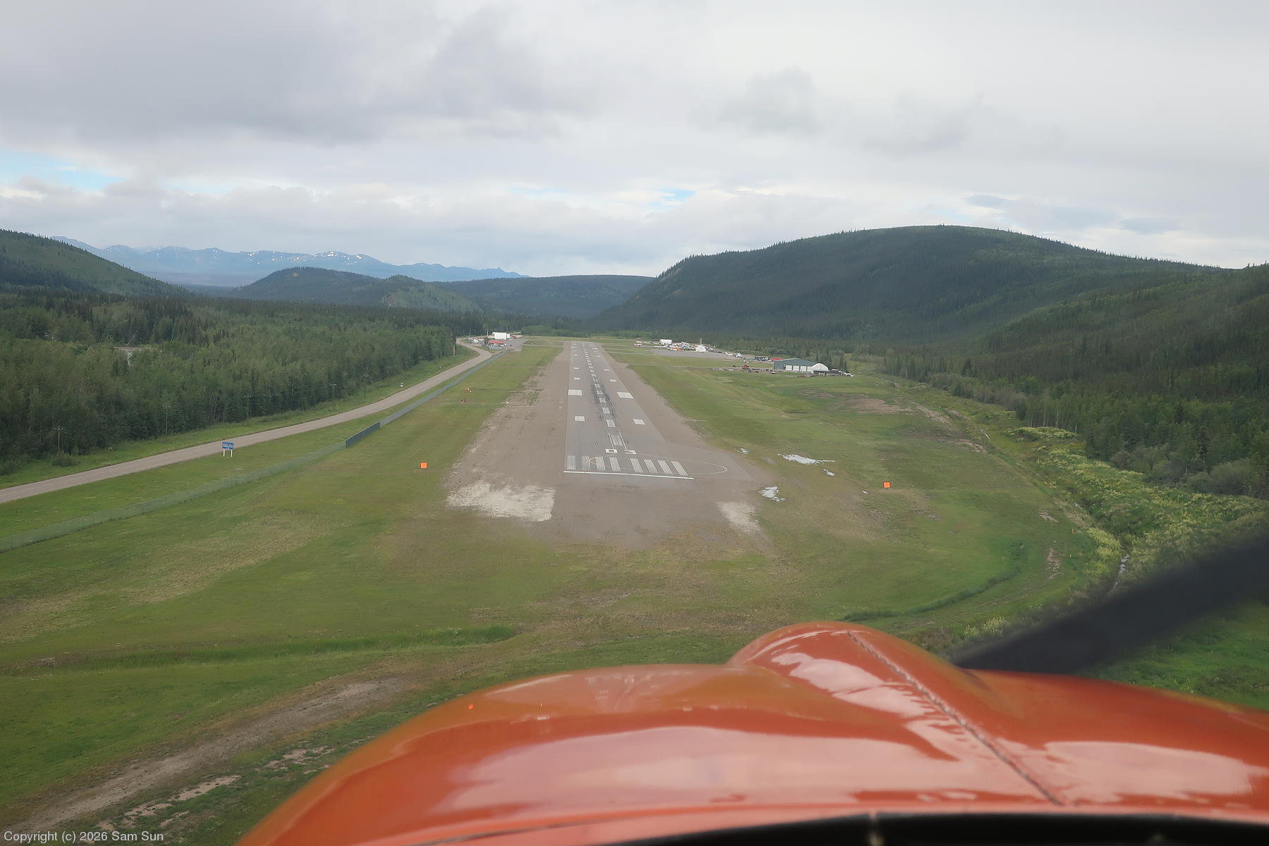
| Final approach, Dawson City |
 |
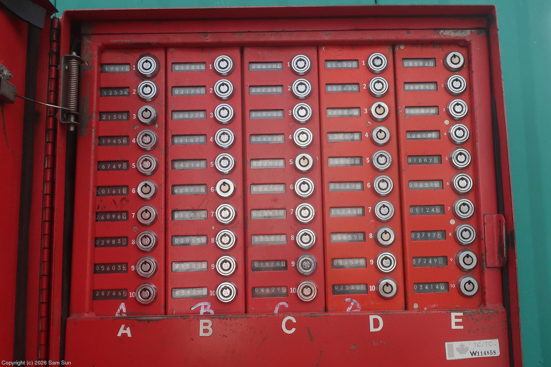
| Fuel key panel |
 |
Fuel sidequest
When I was planning for this trip, I tried to confirm fuel and ramp access with every airport/FBO along my route. Dawson City had been an issue because the FBO number just rang through to a voicemail box that was full. I eventually spoke with someone at the airport office, who assured me that fuel was available 24/7 through a cardlock system. That was technically true, just not the way I assumed.
Upon arrival, I pulled up to the fuel shack and found instructions for an arcane process. The key(s) for the fuel pump were in one of several combo lockboxes for the various operators and FBOs using the airport. Of course, I didn't have a lockbox combo and the number to call to get it was... the one that went to the full voicemail box. An alternate number listed went to a voicemail box that wasn't full, so I left a message and waited...
I didn't want to leave fueling until my departure day as I'd be on the customs clock getting to Fairbanks, so I started asking around the airport offices to see what assistance I could get. I found someone who said calling the number written on the poster at the fuel shack should work... until we determined that the poster had been reprinted with the "good" number removed for some reason. After providing my tail number and credit card info to the mysterious guy at the other end of this new unadvertised number (Hope it's not a scam, but I need the avgas!), I got the lockbox code. Now armed with the pump key, it went into a specific slot in a communal fuel metering system the likes of which I'd never seen. As the guy on the phone had no other way to verify the meter, I had to send him photos of the readouts before and after I fueled. The whole thing was reminiscent of a video game quest.
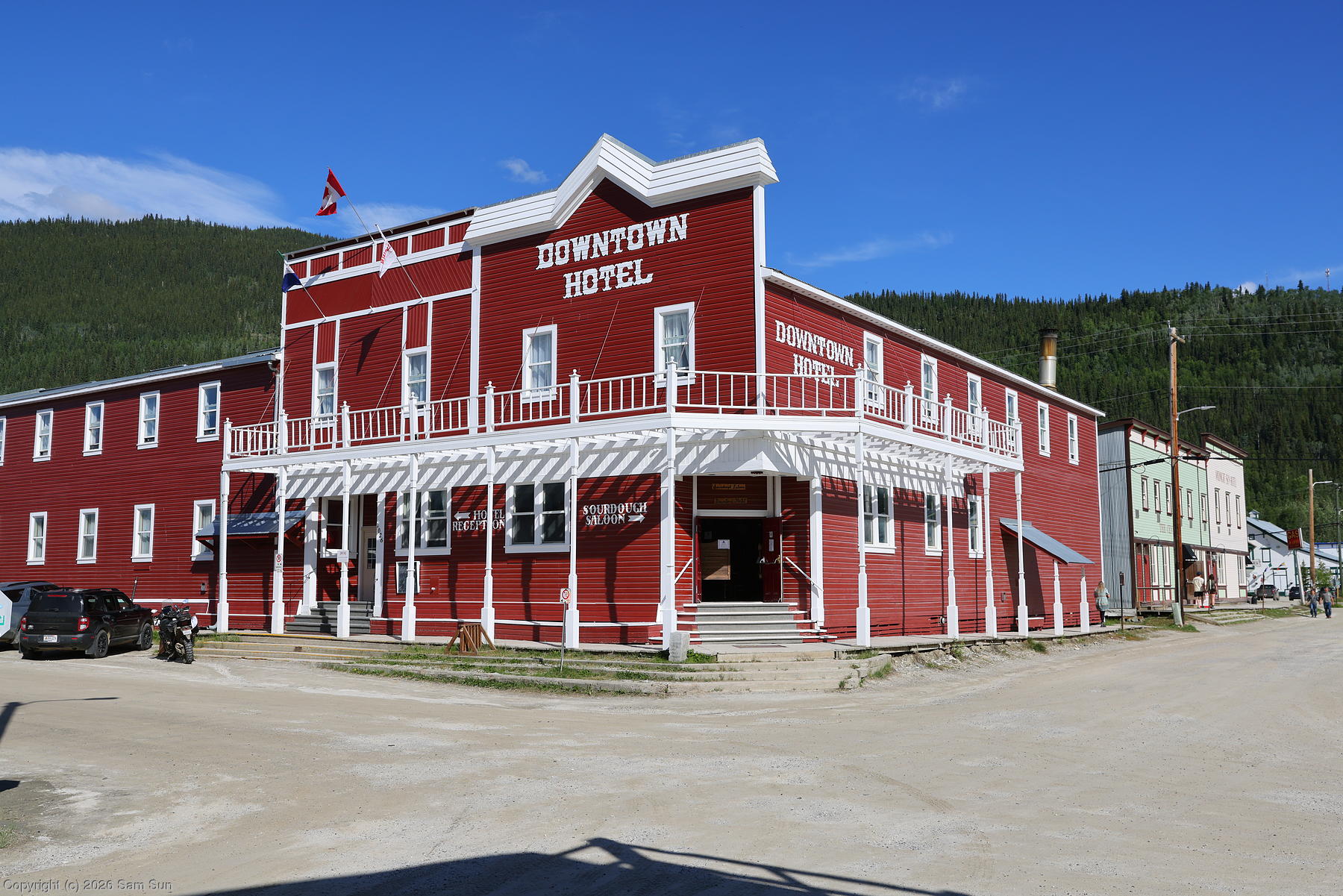
Fueling complete, I encountered another issue. There's no car rental or taxi service in Dawson City, but the hotel I was staying at (The Downtown) offered airport pickup. I had arranged to call upon my arrival, but upon doing so, the voice quality was so poor it was nearly impossible for either side to understand what was being said. After a bit of back and forth, they assumed I was trying to make a reservation, said they were sold out, and hung up. I ultimately hitched a ride into town.
I celebrated Independence Day in Dawson City, where they were fresh off their own Canada Day festivities. With no rental car to travel independently, I booked a day trip through Tombstone Territorial Park and an evening trip to Midnight Dome, which overlooks the town. The next day, I went on the Klondike Spirit paddlewheel cruise on the Yukon River. While 2 hours long, it only went about 3km downstream to Moosehide before having to fight its way back upstream against the current.
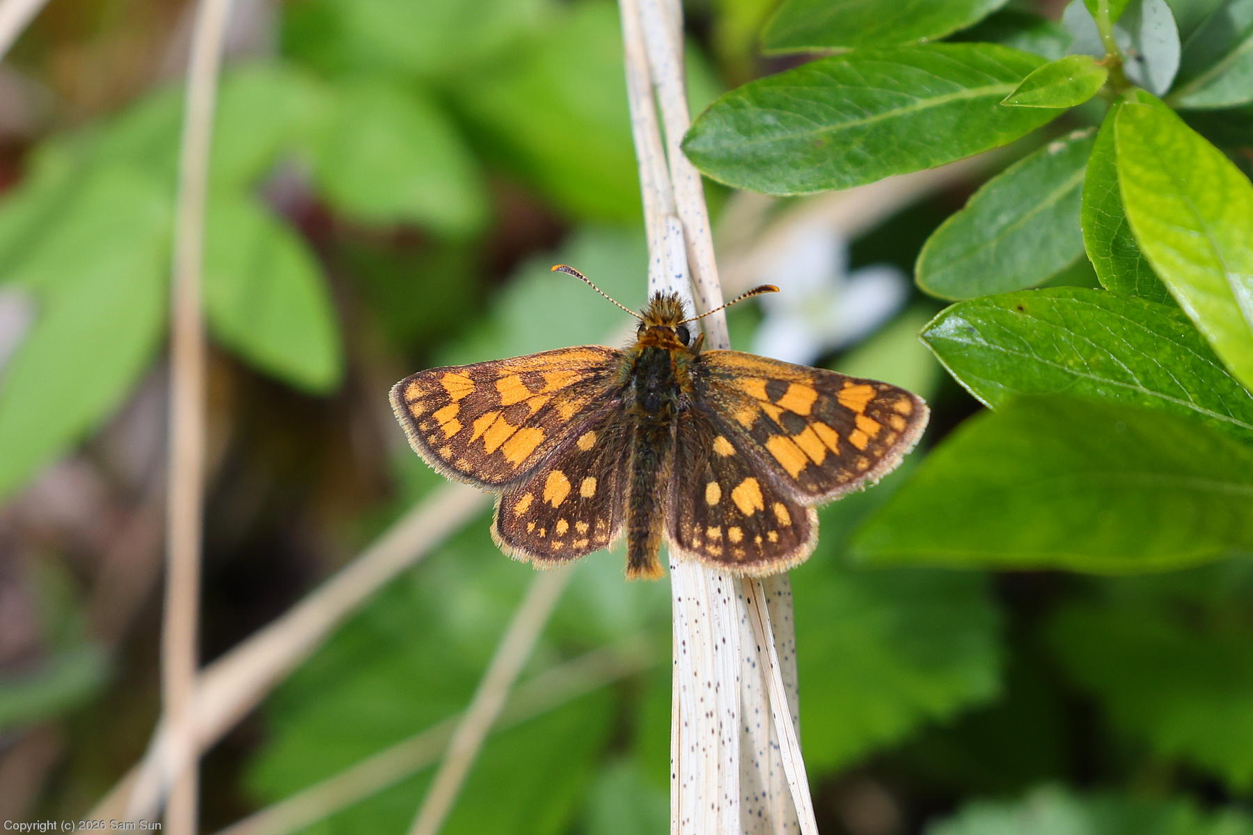
| Arctic Skipper |
 |
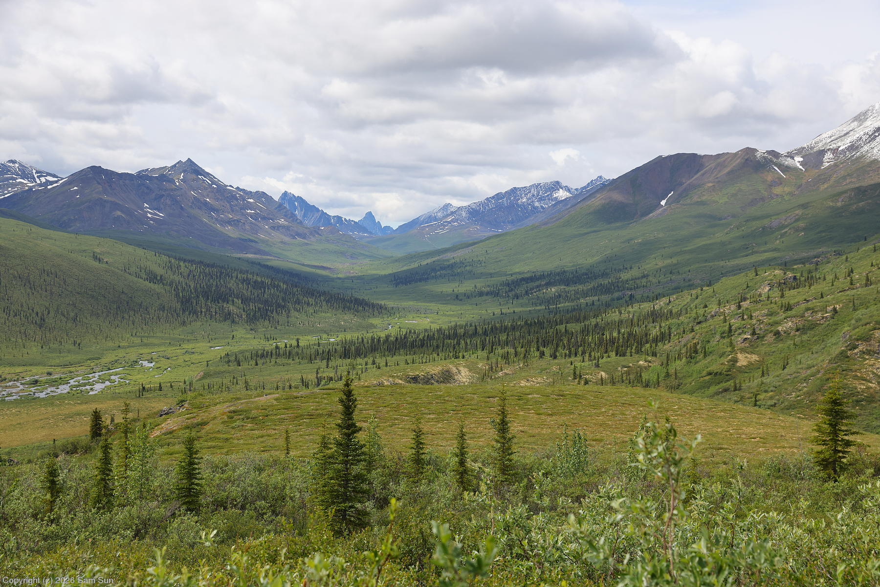
| Tombstone Mountain is the bump in the far distance |
 |
| Historic frontage |
 |
| Dredge tailings outside of town |
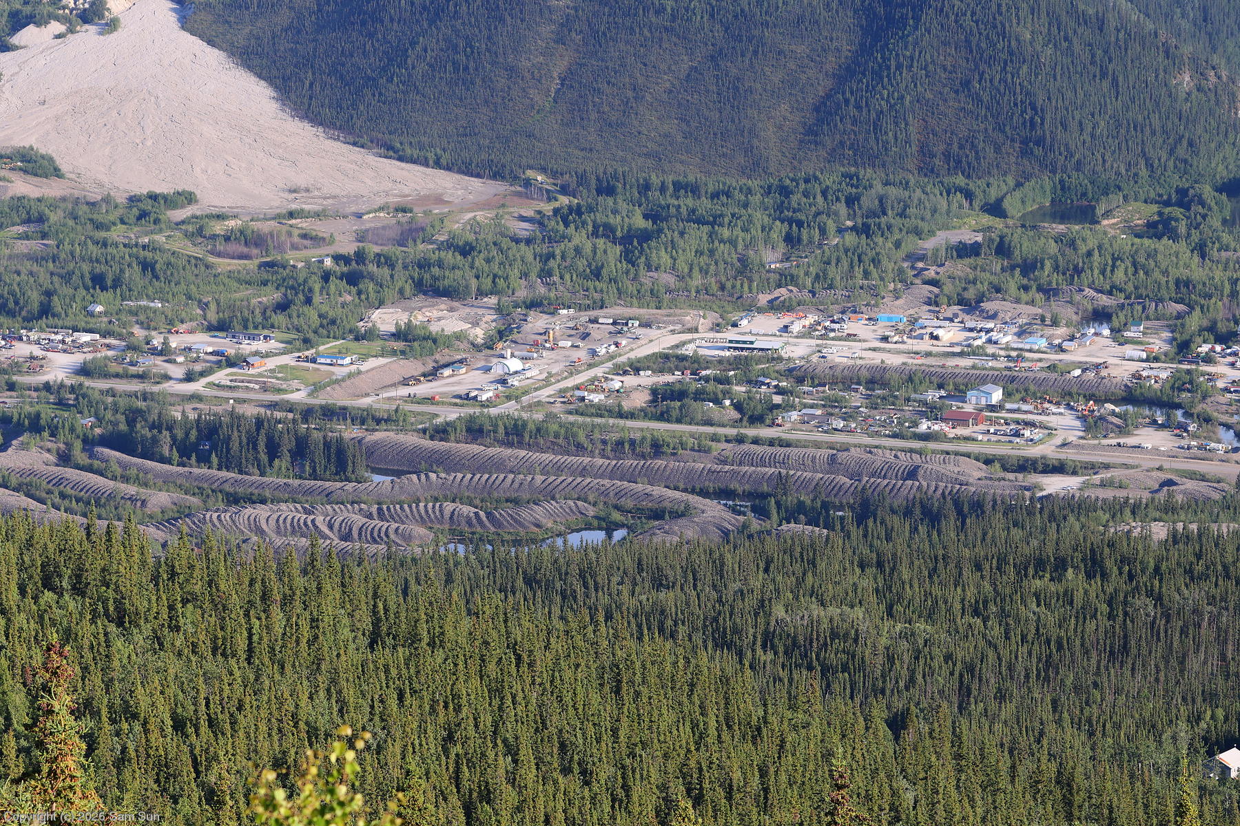 |
Dawson City was the epicenter of the Klondike Gold Rush. After gold was discovered in nearby Bonanza Creek in 1896, the town exploded from a population of a few hundred to tens of thousands. The boom ended almost as quickly as it started - when gold was discovered in Nome in 1898, many prospectors left to seek their fortune there. The impacts of the early mining era are still obvious today. Dredge tailings wind like serpents outside of town. Most of the forests are second-growth, the original timber having been cut to build cabins or fuel mining operations. Although the methods and scale have evolved, mining activities in the area continue to this day, with most operations being small family run affairs.
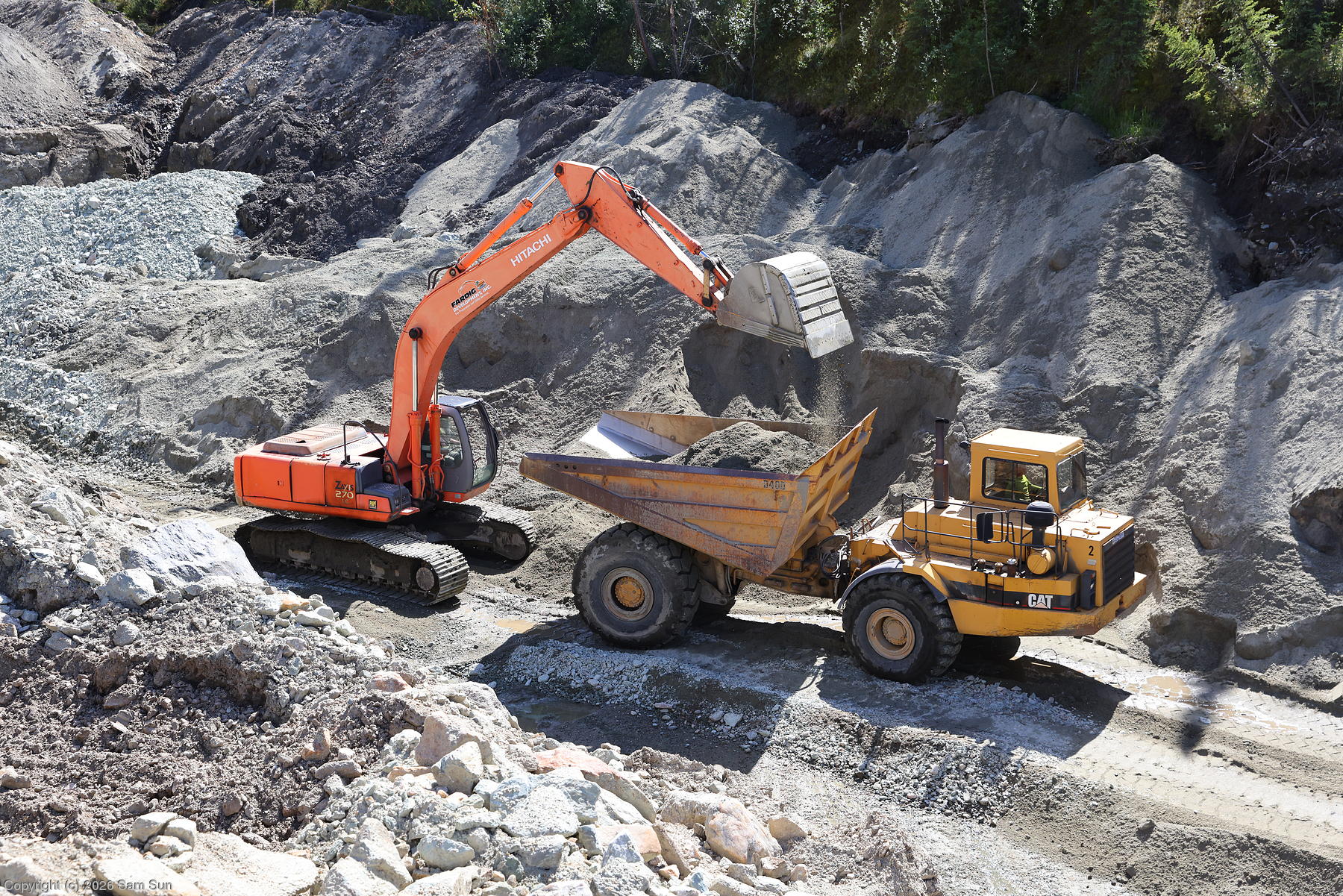
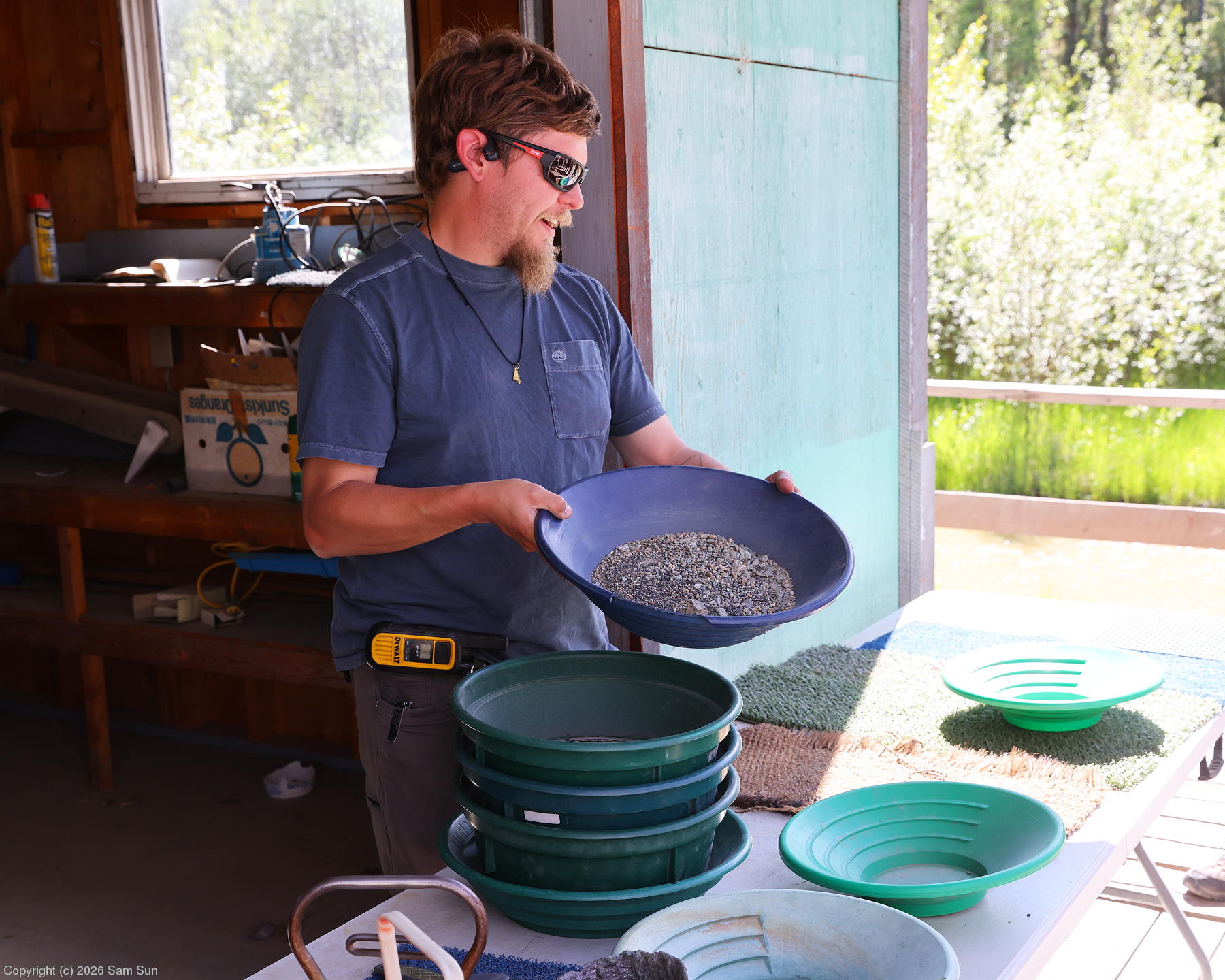
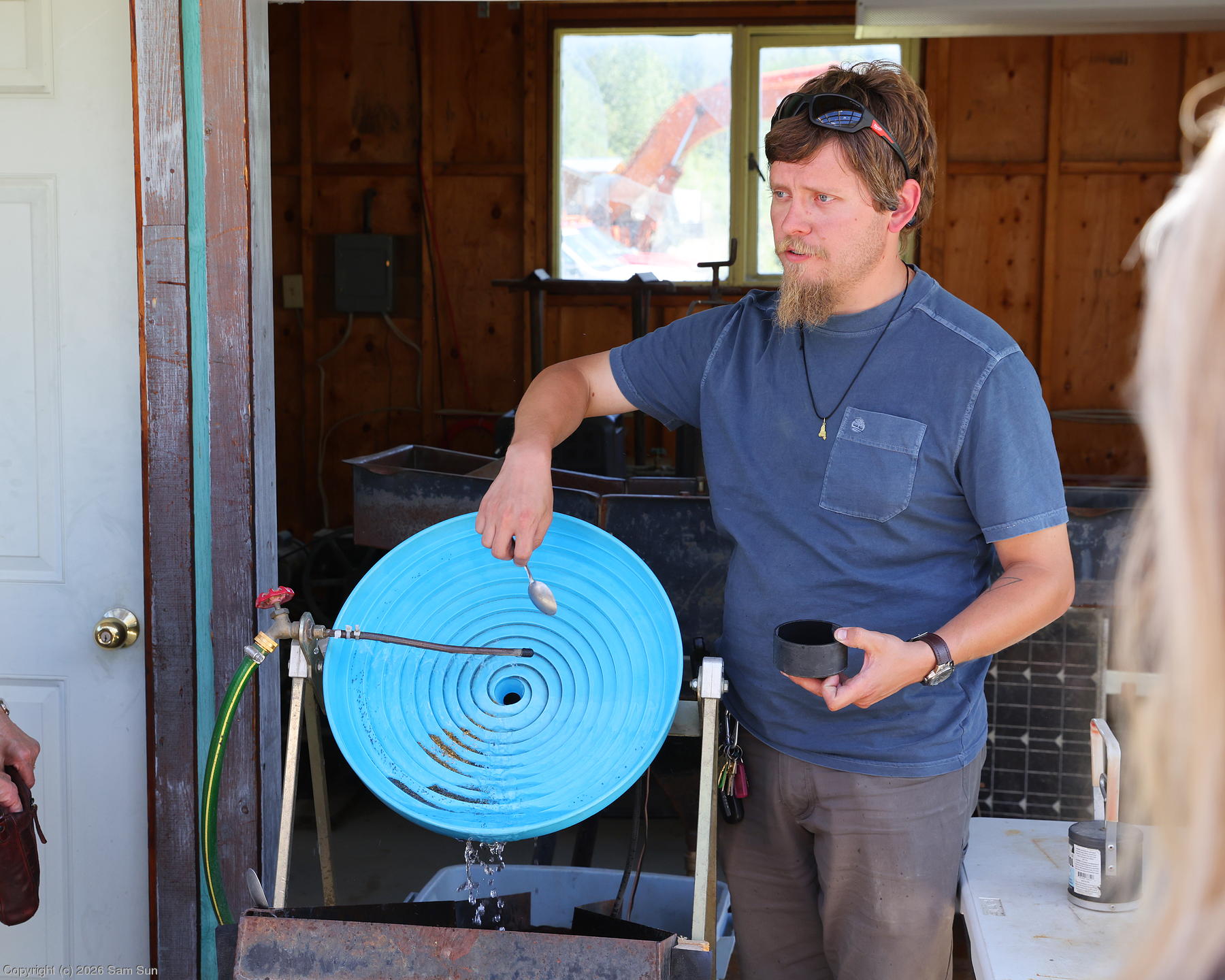
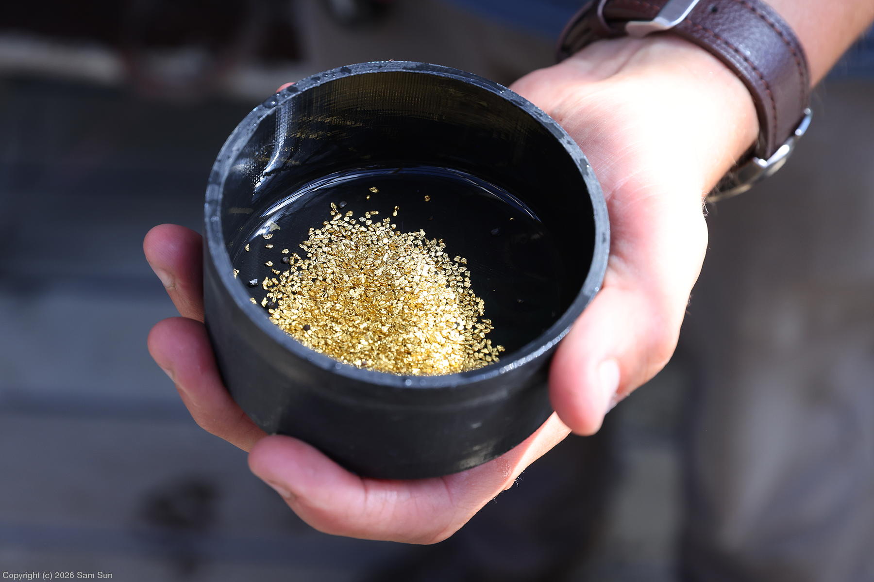
In the afternoon, I went on the Goldbottom Mine tour, which visited one of these active mining operations. Our guide's father and sisters were the ones operating the heavy equipment while we were on the tour! He described his placer mining job as "washing dirt". From a truckload of creekbed dirt, the material was run through a large sluice, then, in a remarkably manual process, winnowed through several stages to what would hopefully be a few ounces of gold. The tour included a gold panning session where I wound up with a couple of flakes.
| Gold mining - first step |
 |
| Winnowing dirt |
 |
| A hypnotic spiral wheel separator |
 |
| The end result |
 |
In between the tours, I had to arrange my return to the United States. While relatively straightforward, the CBP requirements always strike me as annoyingly redundant: You must file an electronic passenger manifest through the eAPIS system. There is no phone option for this, so you must therefore be somewhere with reasonable internet connectivity. The eAPIS manifest requires information such as your arrival airport of entry and time. Having submitted this, you must then call that airport of entry, during business hours, and speak to a CBP officer to be granted permission to arrive at the appointed time (plus or minus 30 minutes). When I called the Fairbanks office immediately after submitting my eAPIS, I was informed it sometimes takes half an hour or so to show up for them, and to try back later. Really? I thought electrons moved faster than that. It was a few hours later after the paddlewheel cruise before I could call back, and happily they had my eAPIS filing and I was granted permission to land.